

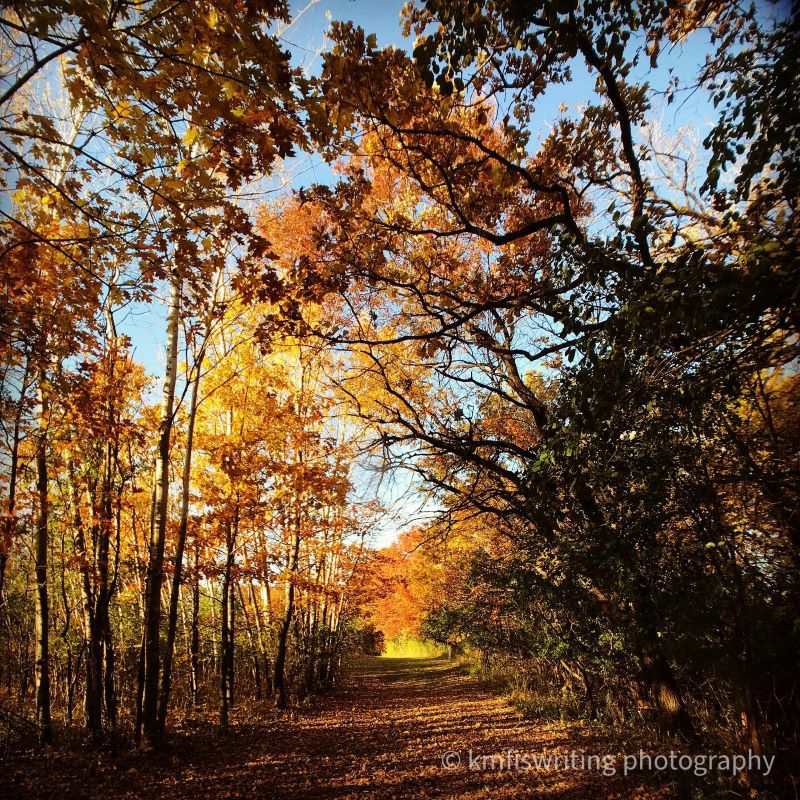
I know I’m not the only one who finds hiking therapeutic – a much-needed sanity break. Fortunately, I live in the Twin Cities, Minnesota. St. Paul and Minneapolis rank #2 and #3 in the nation for the best parks. And these best parks feature the best hiking trails with trees and water that nourish my soul.
In the land of 10,000+ lakes and 17.6 million acres of forest, I find it remarkable that all Minnesota residents live within 50 miles of at least one state park (although I did read that it changed to 30 miles). Myself included – in fact, five Minnesota state parks are within that distance of my front door (give or take a couple of miles). That makes it super convenient to discover and explore the best hiking trails in Minnesota and the Twin Cities.
Five state parks.
All within 50 miles of me.
And prior to 2020, I had only been to one of those five state parks (only six in the entire state). I have now hiked/visited all 66 Minnesota state parks as well as several of the state’s recreation areas and multi-purpose state trails, regional and county parks, municipal parks and city parks.
Article originally published: Nov. 17, 2020; Updated June 2, 2023.
Best hiking trails within 50 miles series
Here is a list of the best hiking trails in Minnesota.
- Best hiking trails within 50 miles of the Twin Cities – Minneapolis and St. Paul, Minnesota
- Best hiking trails within 50 miles of Lake Minnetonka, Minnesota
- Best hiking trails within 50 miles of Rochester, Minnesota
- Best hiking trails within 50 miles of Duluth, Minnesota
Note: Not in Minnesota? Check out this article / guide on the best state parks throughout the U.S. where I partnered with more than 30 travel bloggers who recommended and reviewed more than 60 state parks in America.
This post contains recommended links to products and services. As an Amazon Associate, I may earn from qualifying purchases. While you will not accrue any additional costs to support my blog, I may receive compensation if you purchase these products and services. All images are taken by kmf and available for digital download.
The top-ranked Minnesota hiking trails and nature walks in the Twin Cities and near Minneapolis and St. Paul
I’m excited to share the best hiking trails and nature walks within 50 miles of the Twin Cities in Minnesota – ranked by distance from the Minneapolis-St. Paul (MSP) International Airport. I chose MSP as base camp since the Twin Cities metro area covers several counties.
All of these recommendations are fairly easy hiking trails meaning they are also the best family-friendly hikes in Minnesota. I’ve also included a few honorable mentions: best hiking trails in Minnesota that fall outside that 50-mile radius.
12 surprising facts about ticks and tips on how to avoid and remove them.
Minnesota hiking trail tips before you go
It’s always a good idea to check the websites of Minnesota state parks, regional parks, county parks, and city parks for the latest seasonal updates.
Please note that some parks shut off water and close facilities and/or trails in the off-season (generally November through March). Many Minnesota state parks also offer summer hiking trail maps and winter hiking trail maps that you can download from home or on your mobile device. This is helpful to know (before you go) which trails are currently open.
Special note during deer season: Several parks in Minnesota host deer hunts November through December every year. Please check each park’s website to see if the park is closed or has limited access to non-hunters. See my related post.
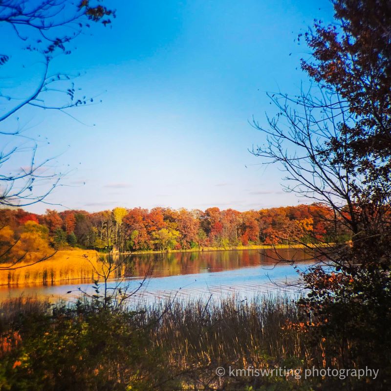
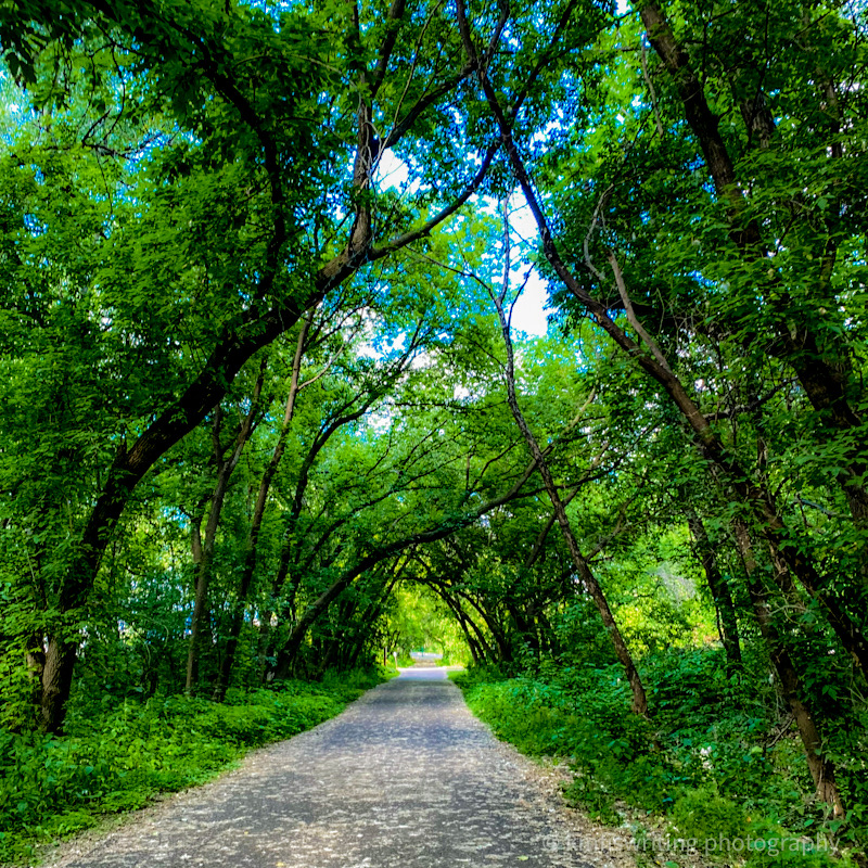
Pike Island Hiking Trail; Fort Snelling State Park; Bloomington, MN

If you ever have a long layover in the Twin Cities at the Minneapolis – St. Paul (MS) International Airport, consider heading over to Fort Snelling State Park. Only two miles away from the airport, the Pike Island Hiking Trail at Fort Snelling State Park is one of the best hiking trails within the Twin Cities, Minnesota metro. Fort Snelling State Park in Bloomington, Minnesota is conveniently located for anyone in the Twin Cities and offers the best hiking in Minnesota.
The hiking trail on Pike Island is pretty flat with a beautiful canopy of trees along both the Minnesota River and Mississippi River. In fact, the trail takes you to the confluence of these two major rivers (where two bodies of water meet).

Distance from Twin Cities: Fort Snelling State Park in St. Paul / Bloomington, MN, is located within the Twin Cities metro – only two miles from the MSP airport.
Trail length: 3.7 miles
Trail difficulty: Easy
Admission: Admission to all Minnesota state parks is $7 per vehicle per day or $35 for an annual vehicle pass (unlimited visits to all 66 Minnesota state parks and 9 Minnesota recreation areas for 12 months from the month of purchase).
Minnehaha Creek Trail; Minnehaha Regional Park; Minneapolis, MN

One of the best places to hike in Minnesota, specifically, the Twin Cities is Minnehaha Regional Park in Minneapolis, MN. You don’t really have to hike far to admire the beautiful 53-foot Minnehaha Falls in one of Minneapolis’ oldest parks (just a short walk from the parking lot). You can then walk down some stairs to get some closer looks at the cascading waterfall and limestone bluffs (or in the winter an up close and personal look at the frozen spires). See related post: Epic frozen waterfall tour: Best day trips from the Twin Cities.

You can hike along Minnehaha Creek or extend a nature walk through Minnehaha’s three gardens: Longfellow Gardens, Minnehaha Falls Pergola Garden, Song of Hiawatha Garden. You’ll also find some historical sites in the Minnehaha Regional Park including Longfellow House, Princess Depot and John H. Stevens House.
And as long as you’re here during spring/summer season, you must eat at one of the best al fresco restaurants in Minneapolis: Sea Salt Eatery.
Distance from Twin Cities: Minnehaha Regional Park is located in Minneapolis, approximately 4 miles from MSP.
Trail length: 2.1 miles
Trail difficulty: Moderate
Admission: Admission to Minnehaha Regional Park in Minneapolis is free; however, you’ll need to pay for parking in the paid lots. Parking on nearby neighborhood streets is free.
Crosby Farm Regional Park; St. Paul, Minn.

At 700 acres, Crosby Farm Regional Park is the largest park in St. Paul, Minnesota. It’s also part of the National Park Service’s Mississippi National River & Recreation Area. You’ll find some of the best hiking trails in the Twin Cities at Crosby Farm Regional Park in every season
We did a winter hike at Crosby Farm Regional Park in February. This is a popular park especially with dog owners. Additionally, we saw cross-country skiers, fat-tire bikers, and even a couple of one-dog sleds.
I recently learned that Crosby Farm Regional Park is also home to a slot canyon. One of our favorite family vacations was hiking at the slot canyons of Lower Antelope Canyon in Page, Arizona. So we definitely want to return to Crosby Farm Regional Park this spring or summer to check that out!
Fun fact: Crosby Farm Regional Park is directly across the Mississippi River from Fort Snelling State Park.
Distance from the Twin Cities: Crosby Farm Regional Park in St. Paul, MN is located within the Twin Cities metro. It is located only 2.5 miles from the MSP International Airport.
Trail length: 3.3-mile loop (although you can connect to other loops and hiking trails at Crosby Farm Regional Park for longer hikes
Trail difficulty: Easy
Admission: Free
Hidden Falls Regional Park; St. Paul, MN

You’ll find nearly 7 miles of paved and dirt trails at Hidden Falls Regional Park in St. Paul, Minn. One of the trails leads to its charming namesake Hidden Falls waterfall. This park’s trails wind through woodlands and along the Mississippi River.
Distance from Twin Cities: Hidden Falls Regional Park is within the Twin Cities and only 4.1 miles from the MSP International Airport.
Trail length: The Hidden Falls Trail is 2.6 miles (although you can create longer or shorter hikes to fit your hiking preference).
Trail difficulty: Easy
Admission: Not applicable.
Summit Ave Historical District; St. Paul, MN
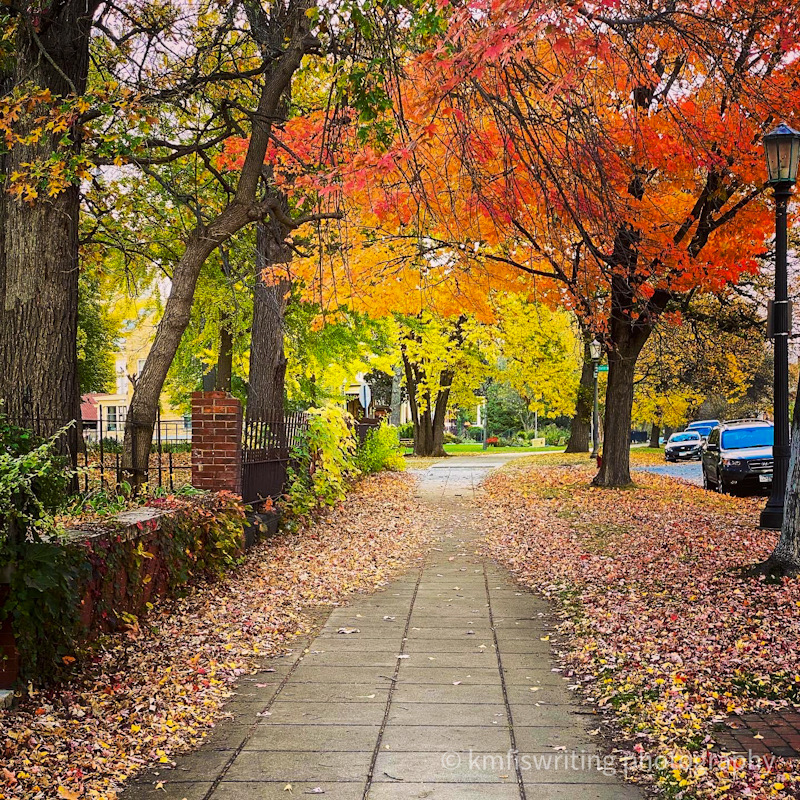
While Summit Ave is not your typical hike, I do highly recommend walking through this beautiful and historical neighborhood – the prettiest street in the Twin Cities. And you’ll get your steps in as you stroll by nearly 400 historical homes built in the late 1800s and early 1900s over 4.5 miles.
Additionally, Summit Ave holds the honor of the most Victorian homes on one street in America. See my related post for more details and beautiful photos: Prettiest street in the Twin Cities – the historic and beautiful homes of Summit Ave.

Distance from Twin Cities: The Summit Ave Historical District is within the Twin Cities and 8 miles from the MSP International Airport.
Trail length: 4.5 miles
Trail difficulty: Easy (although some of the paved sidewalks may be uneven, cobblestone, brick, etc.)
Admission: Not applicable.
Winchell Trail, Mississippi Gorge Park; Minneapolis, Minn.
One of the prettiest and best hiking trails in Minneapolis is Winchell Trail located in the Mississippi Gorge Regional Park (there are other trails in this park as well). An ancient Native American Trail and part of the Grand Rounds Scenic Byway, the Winchell Trail winds along the Mississippi River right in the heart of the Twin Cities. We hiked after the leaves had peaked in October, and it was still gorgeous.
Winchell Trail is located at 4357-4367 W. River Parkway in Minneapolis. You’ll find free parking lots and curbside parking where you can access the trail in several locations. You’ll find paved areas as well as more rugged sections if you choose to hike near the river. Please use caution especially around the steep bluffs.
Distance from Twin Cities: Winchell Trail in the Mississippi Gorge Regional Park is 5.2 miles from Minneapolis – St. Paul (MSP) International Airport.
Trail length: 5.4 miles (out and back; however, you can adjust the distance)
Trail difficulty: Easy (although you may come across some stairs, uneven terrain, and steep inclines)
Admission: Not applicable.
Shadow Falls Park; St. Paul, Minn.
For a beautiful overlook of the Mississippi River, visit Shadow Falls Park in St. Paul, Minn. The overlook to this majestic river is just a short distance from the parking lot. And then you can take a three-mile trail that takes you around Shadow Falls Park and through a wooded area that leads you to this hidden gem of a waterfall, Shadow Falls. See related post for the best hiking trails with frozen waterfalls near the Twin Cities.
Winter hiking in Minnesota
I attempted to hike this trail in January. While the path along the street was clear, the path to the overlook was solid ice and trail conditions to the falls were not great (and I didn’t have the right boots – see related post). So be careful if visiting in the winter. Because of the conditions (and that it was so cold my fingers stopped working – safety first!), I cut my visit short so will need to return to hike down the trail that leads to Shadow Falls.
Until then, here is a beautiful autumn shot of Shadow Falls taken by a fellow Twin Cities and nature enthusiast who gave me permission to repost on my blog. Check out MarkG Photography on Instagram and give him a follow.

Distance from Twin Cities: Shadow Falls Park in St. Paul, Minnesota is within the Twin Cities and 6.5 miles from the MSP International Airport.
Trail length: 3 miles
Trail difficulty: Easy to moderate
Admission: Admission to Shadow Falls Park is free.

Best winter hiking boots
I now don’t leave my home in the winter to go hiking without my Columbia Bugaboot Plus IV Omni-Heat Snow Boots. They’ve got Michelin tread! They keep my feet warm (which previously was nearly impossible) and dry. Check out my review and other travel-related gifts that wanderlusts really want.
Note that I am an Amazon affiliate so if you click on any of my links and make a purchase, I may receive a small commission at no extra cost to you. I only recommend products and services I love and would use or try myself. In fact, we just purchased a pair of Columbia Bugaboot Plus IV Omni-Heat Snow Boots for my husband that’ll came in handy as we hiked along the North Shore (the most scenic road trip in Minnesota) in the winter.
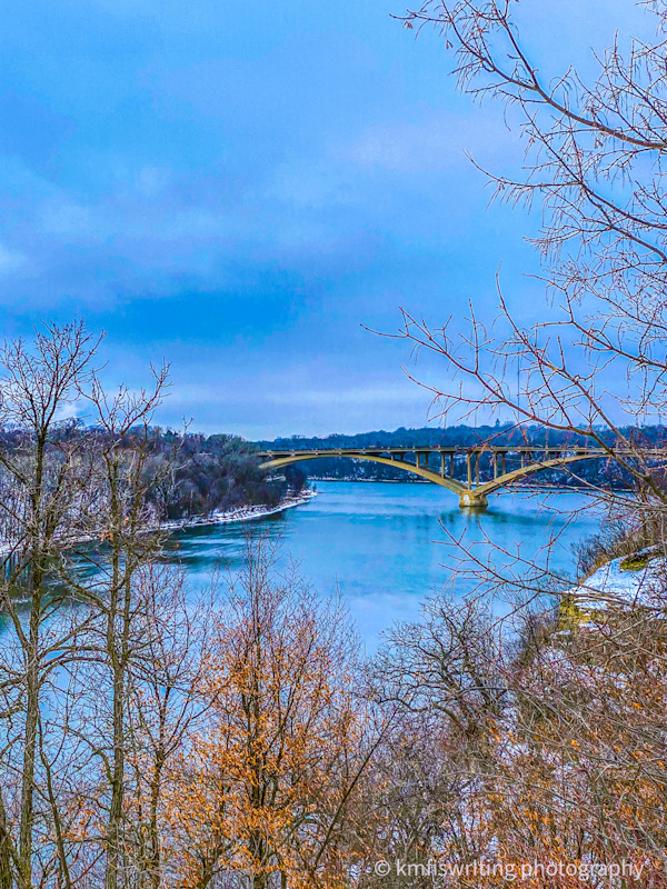
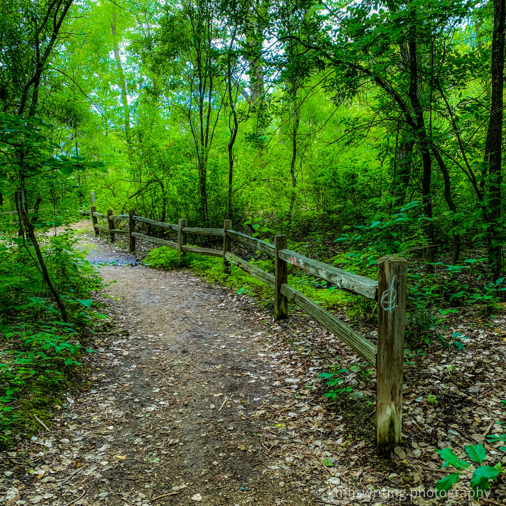
Old Cedar Avenue Bridge; Minnesota Valley National Wildlife Refuge

I’ve lived in the Twin Cities for 30 years and have crossed over the Cedar Avenue Bridge thousands of times. I’ve noticed the Old Cedar Avenue Bridge in the distance, but didn’t pay much attention to it. It wasn’t until this summer that I learned there is a really cool trailhead that leads to the Old Cedar Avenue bridge. And that there’s a hiking and bike trail right next to the Cedar Avenue Bridge in Bloomington, MN. Hike or bike over the bridge to get to the Minnesota Valley National Wildlife Refuge trails along the Minnesota River.

The Old Cedar Ave Bridge trailhead will also lead you to a hiking and bike trail under the main Cedar Avenue Bridge with some really cool views.
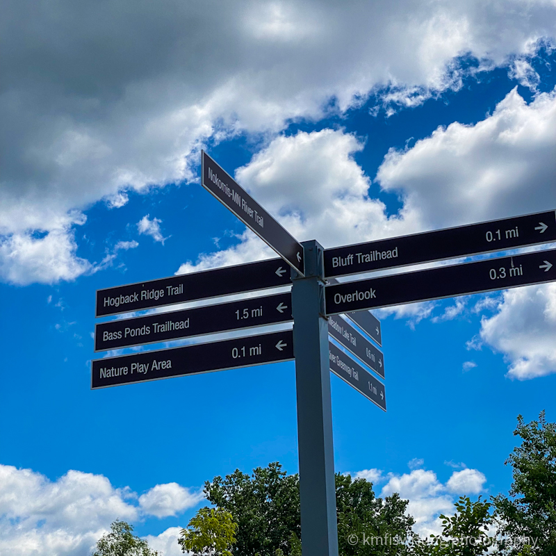
The Old Cedar Avenue Bridge trailhead also leads you to several more of the best hiking trails in the Twin Cities (and bike trails also).
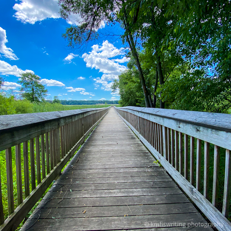
I especially love the boardwalk that leads to the overlook. Once you get to the end of the boardwalk surrounded by wetlands, you can see the Old Cedar Avenue Bridge in the distance.

Distance from Twin Cities: Old Cedar Bridge Trailhead in Bloomington Minnesota, is just two miles from the Mall of America. And this top hiking trail in the Twin Cities is only 6.6 miles from the MSP International Airport.
Trail length: That depends. If you choose to hike the entire Old Cedar Avenue Bridge loop (Long Meadow Lake and the Bluff Trail), it is about 7 miles total. This trail loop will take you up and down both sides of the Minnesota River. However, you can adjust your distance to fit your preference. Just hike out and back after a certain time or distance.
Trail difficulty: Easy – paved, boardwalk, and dirt hiking trails
Admission: Free – with lots of free parking
Brickyard Trail; Lilydale Regional Park to Harriet Island Regional Park; St. Paul, Minnesota
A relatively short, but moderately challenging, hike is the Brickyard Trail at Lilydale Regional Park. This scenic hike provides some views of the Mississippi River from the shore as well as from the bluffs and then connects with the Harriet Island – Cherokee Bluffs trail. See below for more details on that hiking trail loop.
One of the best hiking trails in the Twin Cities is also historic. According to the National Park System, Brickyard Trail gets its name from the former site of the Twin Cities Brick Company, which operated from the late 1800s until the 1970s. Learn more.
Caution while hiking
Please use extreme caution and stay on the marked trails as this area is prone to landslides and unstable slopes. A map at the Brickyard trailhead shows exactly which areas are marked, and which are restricted. This trail is part of the Mississippi National River and Recreation Area.
Distance from Twin Cities: Lilydale Regional Park, located in St. Paul, Minnesota, is within the Twin Cities and 6.6 miles from the MSP International Airport.
Trail length: 1.8-mile loop
Trail difficulty: Moderate with a few inclines and sometimes muddy and rugged terrain
Admission: Admission to Lilydale Regional Park is free.
Harriet Island to Cherokee Bluffs Trail; Harriet Island Regional Park; St. Paul, Minnesota
Harriett Island Regional Park is one of the most popular parks in St. Paul, Minnesota. Located on the Mississippi River, it’s home to river cruise sightseeing boats, large events, playgrounds for kids, a bandshell for concerts, and more. Additionally, you will find one of the best hiking trails in the Twin Cities – a 4.4 mile-loop from Harriet Island Park to Cherokee Bluffs.
You may need to share the trail with cyclists, but it’s still a great place to hike among the trees, the bluffs, and the river.
Distance from Twin Cities: Harriett Island Regional Park, located in St. Paul, Minnesota, is within the Twin Cities and 8.8 miles from the MSP International Airport.
Trail length: 4.4-mile loop
Trail difficulty: Easy to moderate with a few inclines and rugged terrain (if you venture onto the Lilydale Brickyard Trail – see above).
Admission: Admission to Harriett Island Regional Park is free.
Mill Ruins Park; Mississippi National River and Recreation Area in Minnesota; Minneapolis, MN

You’ll find several hiking trails and things to do along the 72-mile Mississippi National River and Recreation Area, a national park that includes state and regional parks (such as Fort Snelling State Park and Minnehaha Regional State Park also mentioned in this post) and national wildlife refuges.
One of my favorite places along the Mississippi National River and Recreation Area is in downtown Minneapolis. It’s more of an urban historical walking tour. I recommend starting at the back of the Mill City Museum that faces the Mississippi River. From there you can hike across the Stone Arch Bridge to Father Hennepin Bluff Park and down the oldest street in Minneapolis – the historic Main Street. You can also follow a path that takes you up close to St. Anthony Falls on the Mississippi River (seasonal). And then cross the 3rd Avenue Bridge and make your way back to the Mill City Museum area.
Other parks and trails in downtown Minneapolis
I also recommend checking out the nearby Mill Ruins Park, Gold Medal Park, I-35W Bridge Remembrance Garden, and capture some cool shots from the Guthrie Theater. For more details about this area, please see my related posts: Riverfront disasters walking tour: I-35W Bridge Remembrance Garden and Top 10 walking tours in the Twin Cities – Minneapolis and St. Paul.
Distance from Twin Cities: Mill Ruins at the Mississippi National River Recreation Area is located in Minneapolis, approximately 9 miles from MSP.
Trail length: 3.2 miles
Trail difficulty: Easy
Admission: Admission to Mill Ruins Park and most attractions along this trail (other than the Mill City Museum) is free.
Best hiking trails in the Twin Cities: Patrick Eagan Park in Eagan, MN
So I worked less than 15 minutes from Patrick Eagan Park in Eagan, Minnesota for more than 16 years. And I had never heard of this park until a few months ago. If only I had known! Could have enjoyed quite a few lunch-break walks back in the day.
Patrick Eagan Park offers a beautiful and easy hiking trail that’s less than 2 miles. You’ll walk along rolling hills, beautiful tall trees, and lakes. This park also features a natural park where kids can play around on playground equipment made out of trees. And Patrick Eagan Park also has a fun kid-friendly (maybe even adult-friendly) zip line and an art house. My niece and I hiked in late fall so looking forward to returning the the beautiful Patrick Eagan Park in the spring and this summer.
Patrick Eagan Park is also super close to Caponi Art Park (1.5 miles away) and Lebanon Hills Regional Park (3.1 miles away) – so you’ve got three of the best hiking trails in the Twin Cities all within walking distance of each other.
Distance from Twin Cities: Patrick Eagan Park in Eagan, MN is about 9 miles from MSP.
Trail length: 1.6 miles
Trail difficulty: Easy
Admission: Admission to Patrick Eagan Park in Eagan, MN is free.
Sculpture Tour Trail; Caponi Art Park; Eagan, MN

Last spring, my husband and I discovered Caponi Art Park, a cool sculpture garden, in Eagan, MN – which is also located in the Minneapolis – St. Paul metro area. The Sculpture Tour is a super easy hiking trail right in the suburbs and offers one of the most unique and best hiking experiences in Minnesota.
You’ll find more than 30 unique pieces of work by Anthony Caponi and other artists in this sculpture garden of 60 wooded acres. You can find an interpretative map on the Caponi Art Park website as well as signs at the park.
Distance from Twin Cities: Caponi Art Park in Eagan, MN, is located within the Twin Cities metro, approximately 10 miles from MSP.
Trail length: 1.4 mile loop
Trail difficulty: Easy
Admission: Admission to the Caponi Art Park is free; however, donations are appreciated.
Lebanon Hills Loop Trail; Lebanon Hills Regional Park; Eagan, MN

At 2,000 acres with nearly 15 miles of hiking trails, Lebanon Hills Regional Park is the largest park in Minnesota’s Dakota County and one of the best places to hike near Minneapolis and St. Paul. One of the more popular hiking trails at Lebanon Hills is the 5.3-mile Lebanon Hills Loop, which takes you around several lakes and wooded areas. This park offers some of the best hiking and snowshoeing trails in the Twin Cities and in Minnesota.

Distance from Twin Cities: Lebanon Hills Regional Park in Eagan, Minn. is located within the Twin Cities metro, approximately 10 miles from MSP.
Trail length: 5.3 mile loop
Trail difficulty: Moderate
Admission: Admission and parking are free at Lebanon Hills Regional Park in Eagan, MN.
Normandale Japanese Garden in Bloomington, Minn.
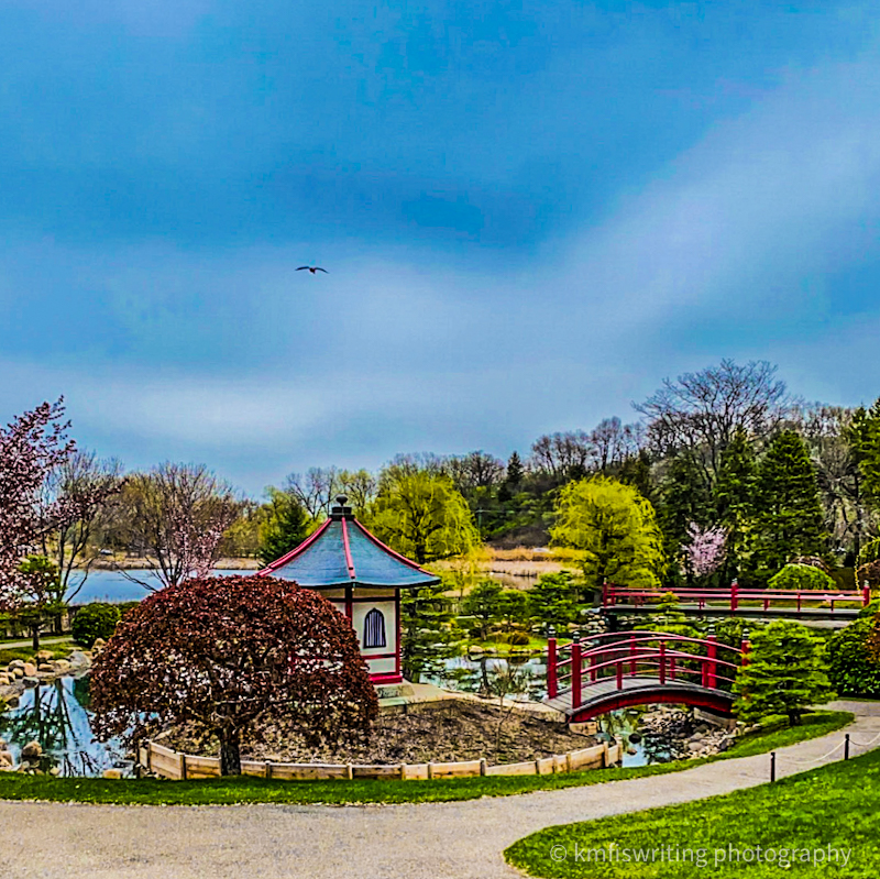
It took me nearly 30 years to discover this hidden gem – the two-acre Japanese Garden located on the Normandale Community College campus in Bloomington, Minn. This used to be my old stomping grounds as I worked nearby for seven years so am surprised I hadn’t heard of the Japanese Garden near Minneapolis before 2020. You can find more than 300 plants, shrubs and trees along a meandering path that takes you around a small pond with coy fish, beside a waterfall and several foot bridges.
It’s interesting to note that the plants and trees are not what you would typically find in gardens in Japan. They needed to feature plants that would survive Minnesota’s harsh winter climates. That includes cherry blossom trees. However, the National Arboretum in Washington DC sent this garden’s architect different seedlings from trees grown in the mountains of Japan – and one fortunately survived. So you can enjoy cherry blossoms in early spring.

Fun facts about Japanese gardens
Each Japanese garden element serves a purpose. For example, the reflection of the drum bridge (taiko-bashi) in the first image creates a circle in the water (from certain angles). And the drum bridge leads to the Normandale Japanese Garden’s hexagonal building, Bentado, named after Benten, the goddess of wealth, happiness, wisdom and music.
The Normandale Japanese Garden is not a strenuous walk or hike; but rather a peaceful and tranquil botanical garden where you can recharge and reflect.
Distance from Twin Cities: The Normandale Japanese Garden is located within the Twin Cities and 10 miles from the MSP International Airport.
Trail length: I’m unable to find the length for the trail at Normandale Japanese Garden, but it is short. I’ll track it the next time I visit and update this post with the distance.
Trail difficulty: Easy tarred path that is accessible.
Admission: The Normandale Japanese Garden is free to all visitors.
Lakewood Cemetery in Minneapolis, Minnesota

One of the most beautiful park settings in the Twin Cities is the Lakewood Cemetery in Minneapolis. This urban cemetery features miles of winding roads to walk or drive, mesmerizing sculptures, poignant memorials and monuments, beautiful flower gardens, intriguing architecture and a stunning reflection pond. You’ll also come across numerous birds and wildlife. I saw geese, ducks, loons, woodpeckers, blue jays, a fox, and more – even wild turkeys.
Notable mentions
This peaceful and serene outdoor gallery is the final resting place for many Twin Cities and Minnesotans including Vice President Hubert H. Humphrey who also served as Minneapolis mayor, a U.S. Senator and the 1968 Democratic presidential nominee. Senator Paul Wellstone and his family are also buried here as is John S. Pillsbury, eighth governor of Minnesota and founder of the Pillsbury Company and the entertainer Tiny Tim.
While Lakewood Cemetery is open to the public, welcomes walkers and runners and holds public and private events, it’s important to remember this is sacred burial ground and visitors should remain respectful at all times as many visitors are mourning the loss of loved ones.
Distance from Twin Cities: Lakewood Cemetery is located within the Twin Cities and 11 miles from the MSP International Airport.
Trail length: You can create your own trail and distance as the roadways are wide. I walked through ~75% of Lakewood Cemetery for 4.5 hours. I’m sure I got my steps and a few miles in.
Trail difficulty: Easy paved roadways throughout Lakewood Cemetery.
Admission: Lakewood Cemetery in Minneapolis is free to all visitors.
Eloise Butler Wildflower Garden and Bird Sanctuary at Theodore Wirth Regional Park in Minneapolis, Minn.

One of three gardens at Theodore Wirth Regional Park in Minneapolis, the Eloise Butler Wildflower Garden and Bird Sanctuary features more than 500 plant species and 130 bird species. A one-mile boardwalk and woodchip interpretative trail leads you through woodlands, prairies and wildflowers. Expect to spend at least one hour.
See the Eloise Butler Wildflower Garden and Bird Sanctuary website for group number limitations as well as their social distancing protocols.
Distance from Twin Cities: Eloise Butler Wildflower Garden and Bird Sanctuary is within the Twin Cities and 13 miles from the MSP International Airport.
Trail length: 1 mile; however, Theodore Wirth Regional Park offers several other trails in its 740 acres.
Trail difficulty: Easy boardwalk with uneven terrain and dirt/woodchip trails with a few slight slopes.
Admission: Not applicable (although you will need to pay for parking – available at a kiosk or via online app).
Silverwood Park in St. Anthony Park, Minn. offers several of the best unique trails in the Twin Cites.

If you’re looking for a unique and beautiful outdoor space, then I recommend Silverwood Park in St. Anthony, Minn. It’s located just north of downtown Minneapolis and features some intriguing trails: outdoor sculpture gallery, forest bathing tour, interactive audio poetry trail and natural history tour.
This family- and dog-friendly park also offers picnic and grill areas, an indoor art gallery, modern restrooms and a cafe.
Distance from Twin Cities: Silverwood Park in St. Anthony, Minnesota is within the Twin Cities and 15 miles from the MSP International Airport (and just a few minutes north of downtown Minneapolis).
Trail length: The Silverwood Park Loop is an 1.4-mile easy and dog-friendly trail. You’ll also find a few other shorter trails within the park.
Trail difficulty: Easy boardwalk, paved and dirt trails.
Admission: Free admission and free parking.
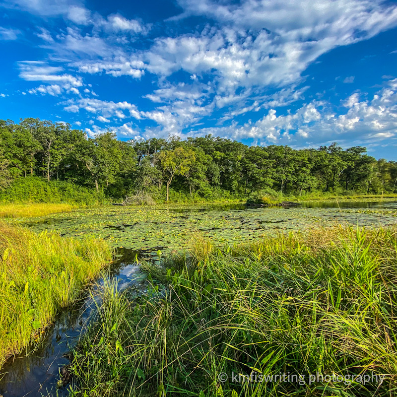
Mazomani Trail; Minnesota Valley National Wildlife Refuge

One of the best hiking trails near Minneapolis and St. Paul is the Mazomani Trail in Shakopee, Minn. Located within the massive Minnesota Valley National Wildlife Refuge, you’ll find lots of solitude and nature. I had originally intended to hike the Louisiana Swamp Trail (which is right next door). However, it had been rainy and there were reports parts of the trail were muddy and washed out.
So I gambled on the Mazomani Trail and it did not disappoint. In addition to the scenic prairie grasses, flowers, wooded areas, and birds, I came across an old farmstead and rock climbers.
Distance from Twin Cities: Mazomani Trail is located 18 miles from the MSP International Airport.
Trail length: According to the AllTrails app, the Mazomani Trail loop is 5.5 miles. However, my Apple Watch clocked me in at more than 8 miles. Maybe I took a scenic route as I am GPS-challenged. AllTrails also features a shorter 2.2-mile loop.
Trail difficulty: Easy, but some of the pathways were overgrown last summer and nearly stepped on a snake. And a fellow hiker and I had to find a way our way over a creek, but it was manageable. A makeshift bridge helped. I’ve also heard that the trail can get muddy so check the MN DNR site for current conditions.
Admission: Free admission and free parking.
Minnregs Lake Loop; Murphy-Hanrehan Park; Prior Lake, MN
One of the best hikes in the Twin Cities is only 15 minutes away from my house. And I only discovered Minneregs Lake Loop at Murphy-Hanrehan Regional Park Reserve recently. This park offers 9 different trails. This particular trail is nearly 6 miles. I noticed that it’s popular with runners and horseback riders along with hikers. Yet, it was very secluded and tranquil.
The Minnregs Lake Loop takes you around a lake, through the woods, prairie grasses, wet lands, and hilly glacier ridges.

Additionally, an off-leash dog park is near another trailhead at Murphy-Hanrehan Regional Park Reserve. This park is also across from a popular mountain bike singletrack trail. In the winter, Murphy-Hanrehan offers the best and most challenging cross-country ski trails.
Distance from Twin Cities: Murphy-Hanrehan Regional Park Reserve is locatedin Prior Lake and Savage, Minnesota. Depending on which trailhead you access, this park is about 19 miles from the Minneapolis-St. Paul International Airport.
Trail length: Trails range from 1.9 miles to 9.5 miles. Minneregs Lake Loop at Murphy-Hanrehan Regional Park Reserve is about 6 miles.
Trail difficulty: Easy to moderately challenging
Admission: Not applicable except for a Minnesota DNR Ski Pass if cross-country skiing on the trails in the winter. Additionally, the equestrian trails require a pass. And you can pay at the dog park to let your furbaby run off leash.
Ritter Farm Park Trail Loop; Ritter Farm Park; Lakeville, Minn.

This gem of a local park (very local for me as it is within walking distance of my house) is located in Lakeville, MN, the southern metro area of the Twin Cities. Hiking at Ritter Farm Park is especially beautiful during the fall season where you can hike through the woods and see glimpses of Lake Marion in the distance. Without a doubt, Ritter Farm Park Loop is one of the best hiking trails in Minnesota.
They also have a popular dog park and this is where my husband I took cross-country ski lessons. See related post: Top 90 things to do in the winter in Minnesota and other brrr-low zero states. We recently did some snow hiking here and it is a winter wonderland.
Distance from Twin Cities: Ritter Farm Park in Lakeville, MN is located within the Twin Cities metro, approximately 20 miles from MSP.
Trail length: 3.2 mile loop
Trail difficulty: Easy
Admission: Admission to Ritter Farm Park in Lakeville, MN is free.
Tamarack Nature Center; White Bear Township, MN
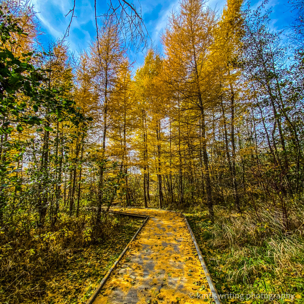
If you’re looking for a beautiful hike – especially in the fall – then I recommend hiking at Tamarack Nature Center. You’ll find six different trail loops to create your own hiking trail. You’ll find boardwalks, pavement, and dirt/grass that take you through beautiful tamarack trees, prairie grasses, and along rivers. Additionally, there is a cool playground for children – making it a perfect outing for families.
The only downside to these trails at Tamarack Nature Center is that you can hear the road noise from the nearby interstate. However, it is still a lovely hike. And I need to return as I heard that there is a fairy house in one of the trees on the Acorn Trail. I was limited on time so didn’t find it on my recent hike.
Special note
Please note that the Tamarack Nature Center does not allow pets or bikes. In the winter, you can cross-country ski on the groomed one-way trails. While you may not hike or snowshoe on the groomed trails, you may access the Bluestem Loop.
Distance from Twin Cities: Tamarack Nature Center is located in White Bear Township about 21 miles north of the Minneapolis-St. Paul International Airport.
Trail length: Trails range from 0.12 miles to 2.5 miles – and you can combine them to create a longer trail.
Trail difficulty: Easy
Admission: Not applicable except for a Minnesota DNR Ski Pass if cross-country skiing on the trails in the winter. .
Schaar’s Bluff Trail; Spring Lake Park Preserve; Hastings, MN
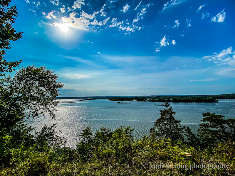
The highlight of Schaar’s Bluff Trail at the Spring Lake Park Preserve in Hastings, Minn. is the view of the Mississippi River. The easy hiking trail will take you through wildflowers, a bit of woods, and sweeping views of one of the longest rivers in the United States and the world. Schaar’s Bluff Trail offers the best views of the Mississippi River and the best hiking in Minnesota.
Many people are surprised to learn the Mississippi River headwaters (where it starts) is located in Minnesota. See my related post: Top things to do at Itasca State Park: Minnesota State Park Challenge.
Distance from Twin Cities: Spring Lake Park Preserve, MN, located in Hastings, MN, is 22 miles from the MSP International Airport.
Trail length: 2.1 mile loop
Trail difficulty: Easy
Admission: Admission to Spring Lake Park Preserve in Hastings, MN is free.
Cleary Lake Trail; Cleary Lake Regional Park; Prior Lake, MN

Cleary Lake Regional Park near Prior Lake offers a 3.4-mile loop trail around Cleary Lake. This popular park also offers a golf course, swimming beach, boat rentals, picnic tables, camping, x-skiing, and more.
The easy all-paved Cleary Lake Trail shares the path with hikers, rollerbladers, and cyclists as well. The loop takes you around Cleary Lake through lots of wooded areas.
Cleary Lake Trail also offers a groomed trail for winter hiking and cross-country skiing trails in the winter.
Distance from Twin Cities: Cleary Lake Regional Park, located near Prior Lake, MN, is 24 miles from the MSP International Airport.
Trail length: 3.4 mile loop
Trail difficulty: Easy
Admission: Admission to Cleary Lake Park Preserve in Prior Lake, MN is free. For winter enthusiasts, you must pay for a ski pass.
See my related post: Best winter hikes in the Twin Cities, Minnesota.
Several of the best hiking trails near the Twin Cities are at Afton State Park; Hastings, MN

The North River Hiking Trail at Afton State Park in Hastings, Minn. is fairly easy/moderate with a few hills and steps. One of the best Minnesota hiking trails takes you along the beautiful St. Croix River and then loops around a beautiful prairie restoration area with some stunning overlooks.
My husband and I started to hike another trail at Afton State Park during our visit last summer; however, we had to cut our hiking adventures short as it was a very hot and humid day with a thunderstorm on its way. Will definitely return especially since Afton State Park offers several more of the best hiking trails near the Twin Cities and in the entire state of Minnesota.
Distance from Twin Cities: Afton State Park in Hastings, MN is 28 miles from the Twin Cities.
Trail length: 3.8 miles (with several other trails ranging from 1.2 miles one-way to a 5.7-mile loop)
Trail difficulty: Easy to Moderate
Admission: Admission to Afton State Park in Hastings, Minn. is $7 per day or $35 for an annual Minnesota State Park pass (unlimited visits to all state parks and recreation areas for 12 months from the month of purchase).
Grey Cloud Dunes Scientific and Natural area; Cottage Grove, Minnesota

Anyone else get the Little House on the Prairie vibe from this pic? Grey Cloud Dunes Scientific and Natural Area (SNA) in Cottage Grove, Minnesota definitely offers that energy. This is one of the best hiking in the Twin Cities – especially if you’re looking for solitude.
You won’t find any official hiking trails in the 237 acres of Grey Cloud Dunes Scientific. But you will find some trodden paths. Stay clear of any sparsely vegetated areas of dune slopes and blow-outs. This fragile habitat is home to sea beach needle grass (rare in Minnesota).
Tip: You can best reach the dunes by parking at the trailhead on 110th Street in Cottage Grove. The dunes crest above the Minnesota River. If you decide to trek to the river, watch out for trains at the railroad station. They go through this area regularly.
Distance from Twin Cities: Grey Cloud Dunes Scientific and Natural Area in Cottage Grove, MN is 34 miles from the MSP International Airport..
Trail length: The path from the dunes to the river is approximately 3 miles.
Trail difficulty: Easy (does have an incline and some uneven terrain – and lots of burrs in the summer)
Admission: Not applicable
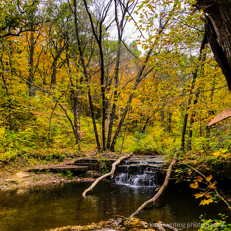
One of the best hiking trails near the Twin Cities is in Wisconsin: Willow River State Park; Hudson, Wisconsin

One of my newest favorite hikes near the Twin Cities is actually across the border in Wisconsin – Willow River State Park near Hudson. And one of the trails leads you to this beautiful waterfall. Expect a bit of a crowd on and near the bridge as well as the falls trail…however, social distancing is manageable.
While you can park near the falls (there is a steep hill), I parked near the dam/beach area and hiked over a mostly flat trail along the lake. On the return trip, I took the less-populated Pioneer Trail (that led to a homesteader’s family cemetery) and a snowshoe trail over rolling hills and through beautiful pines, woods and prairies.
Distance from Twin Cities: Willow River State Park in Hudson, Wisconsin is only 34 miles from the Twin Cities – Minneapolis and St. Paul, Minnesota.
Trail length: Willow Falls Trail to Burkhardt Trail is about 2 miles (although stairs to the overlook are currently closed). For a longer trek, Willow Falls and Nelson Farm Trail winds around for about 6.1 miles whereas the Pioneer Trail to Willow Falls and Burkhardt Trail is 4.6 miles. For a shorter hike, take the 1-mile Hidden Ponds Nature Trail.
Trail difficulty: Easy asphalt bike paths (with a steep slow near the Willow Falls parking lot) as well as dirt trails.
Admission: Expect to pay a daily out-of-state pass for $8 or an annual pass for $38 (less expensive for vehicles with Wisconsin plates or 65 years or older).
Best hiking trail (and bike path) with a waterfall near the Twin Cities; Cannon Valley Trail; Cannon Falls, Minnesota
One of the best hiking trails (and bike trails) near the Twin Cities is the Cannon Valley Trail in Cannon Falls, Minn. with trailheads also located at Welch Village in Welch, Minn. and Red Wing, Minn. However, I recommend starting this National Recreation Trail in Cannon Falls, Minn. as the path runs alongside the beautiful Cannon Falls waterfall. See related post: Epic frozen waterfall tour: Best day trips from the Twin Cities.
There’s also a small lake nearby where you can see swans, ducks and other wildlife. The 20-mile (one way) path, once a railway, will take you along the Cannon River, river bluffs, wetlands, lakes, wooded areas and farmland.
Good to know about Cannon Valley Trail
Directions to Cannon Falls waterfall: The waterfall on the Cannon Valley Trail in Cannon Falls is best accessed by parking at the Cannon Valley Trailhead parking lot at 500 Main Street W., Cannon Falls, MN.
Distance from Twin Cities: Cannon Falls, Minnesota is 35 miles from the Twin Cities – Minneapolis and St. Paul, Minnesota.
Trail length: 20 miles one-way from Cannon Falls to Red Wing, Minnesota (40 miles roundtrip with a trailhead also located at Welch Village)
Trail difficulty: Easy asphalt bike path (with a few small slopes)
Admission: Parking at the Cannon Valley Trail traihead parking lot at 500 Main Street W., in Cannon Falls, MN is free. Hiking on the Cannon Valley Trail is also free; however, a wheel pass is required for any cyclists 18 and over between April 1 through Nov. 1.
Some of the best hiking trails near the Twin Cities: William O’Brien State Park; Marine On St. Croix, MN

One of the best state parks, William O’Brien State Park in Marine On St. Croix / Scandia, Minn. features 12 miles of the best hiking trails in Minnesota (maybe 16 – I’ve seen different numbers) along the St. Croix River, through an oak savannah, prairie grasses, wetlands, 100-year-old pines, sandstone outcrops and fields of wildflowers – and was surprised to come across an old trestle.

Hiking trail details
One of the smaller hiking trails at William O’Brien State Park, Beaver Lodge Trail, passes by a small pond with a beaver lodge. Although I didn’t see any beavers, it was a peaceful area to sit and eat my lunch. I also loved the Riverside Hiking Trail right along the St. Croix River – so beautiful.
And there’s a loop that takes you to a scenic overlook of the St. Croix River Valley. You’ll also find Lake Alice at William O’Brien. It’s a small lake with a swimming beach and a fishing dock. Additionally, the park offers a picnic area with tables, a shelter and grills.
Distance from Twin Cities: William O’Brien State Park in Marine on the St. Croix, MN is 42 miles from the Twin Cities.
Beaver Lodge Trail length: 1 mile (one-way)
Wedge Hill Savannah Trail length: 1.5-mile loop
Prairie Overlook Trail length: 3.8 miles (one-way)
Trail difficulty: Easy
Admission: Admission to William O’Brien State Park in Hastings, Minn. is $7 per day. Or purchase an annual Minnesota state Park pass for $35. This includes unlimited visits to all state parks and recreation areas for 12 months from the month of purchase).
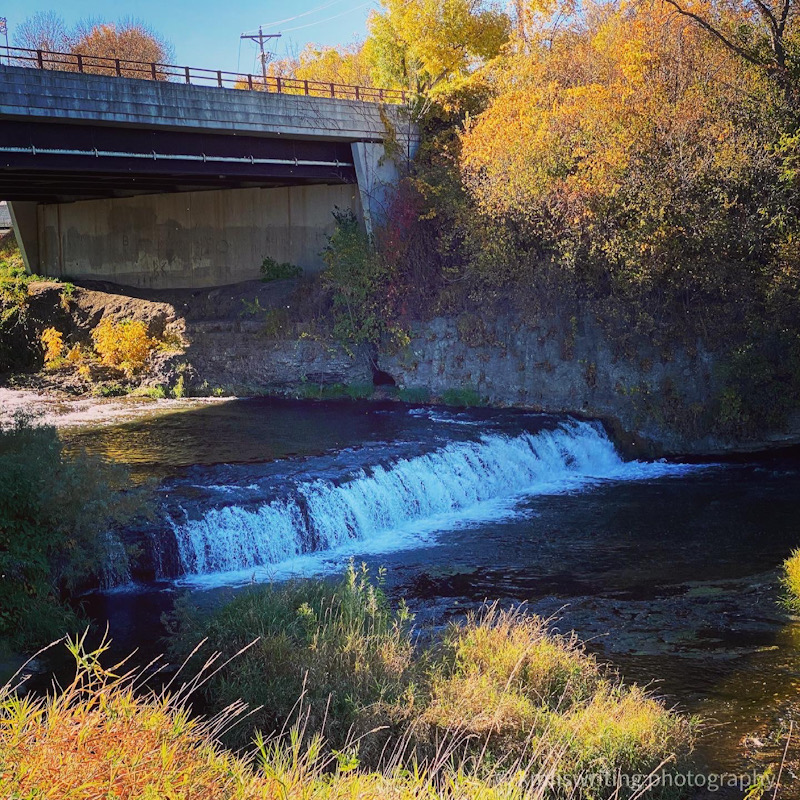
Caron Falls Trail; Caron Falls Park; Northfield, Minnesota
Caron Falls Park in rural Rice County, Minnesota near Northfield features a small, but pretty, waterfall. You’ll find it at the end of the 1.5-mile hiking trail (3 miles roundtrip). We hiked this trail at the end of September. The wooded paths provided a beautiful hike at the beginning of the fall foliage season. Caron Falls Park Trail is one of the most underrated and best hiking trails in Minnesota.
Distance from Twin Cities: Caron Falls Trail is near Northfield and only three miles from Nerstrand Big Woods State Park. It is 49 miles from the MSP International Airport. Note: Nerstrand Big Woods State Park is very popular and reaches capacity often. Caron Falls Park is a great alternative if you get turned away at Nerstrand Big Woods.
Trail length: 3 miles
Trail difficulty: Easy – although we did use stepping stones to cross a low-lying creek. I may or may not have stepped into on the return trip. If you read my Itasca State Park experience, you’ll see there seems to be a pattern here.
Admission: Admission to Caron Falls Trail in Northfield, MN is free.
See what this charming waterfall looks like in the winter: Epic frozen waterfall tour: Best day trips from the Twin Cities.
Other beautiful hiking trails in Minnesota

You’ll find even more of the best MN hiking trails outside of the 50-mile radius of the Twin Cities. This includes Barn Bluff North and South Trails in Red Wing, Minn. and Nerstrand Big Woods State Park. Both are only 52 miles away. And the very popular Taylor’s Falls (aka Interstate State Park – pictured) is 57 miles away. It’s much closer if you’re in the north metro. One of my favorites, Frontenac State Park, is 64 miles, but closer if you’re in the south metro.
And some of my favorite hiking trails in Minnesota are along the North Shore of Lake Superior. These trails are three to five hours away from the Twin Cities. The North Shore also makes a very scenic drive. See my related post: Most scenic road trip in Minnesota: North Shore on Lake Superior.
I missed traveling around the country and the world in the early days of the pandemic. But I am grateful that I discovered and rediscovered so many beautiful parks and nearby MN hiking trails. And all right here in my own backyard so close to the Twin Cities of Minneapolis and St. Paul. I hope you’re inspired to get outside and do some hiking in Minnesota. It’s the land of 10,000 lakes and the best hiking trails.
Sign up for a discounted local’s guide to all Minnesota State Parks!
List of the best MN state parks I’ve hiked/visited

For those asking: how to find a state park near me, here’s a list of the best Minnesota state parks. This list includes the distance from the Minneapolis – St. Paul International Airport. The distances may be closer depending on where you live or are visiting in the Twin Cities area). Full disclosure: All of the MN state parks are the best – I haven’t met one I didn’t like yet.
- Afton State Park | Hastings, MN (26 miles)
- Banning State Park | Sandstone, MN (97 miles)
- Bear Head Lake State Park | Ely, MN (240 miles)
- Beaver Creek Valley State Park | Caledonia, MN (148 miles)
- Big Stone Lake State Park | Ortonville, MN (186 miles)
- Blue Mounds State Park | Luverne, MN (208 miles)
- Buffalo River State Park | Glyndon, MN (240 miles)
- Camden State Park | Lynd, MN (161 miles)
- Carley State Park | Plainview, MN (88 miles)
- Cascade River State Park | Lutsen, MN (257 miles)
- Charles A. Lindbergh State Park | Little Falls, MN (112 miles)
- Crow Wing State Park | Brainerd, MN (134 miles)
- Father Hennepin State Park | Isle, MN (113 miles)
- Flandrau State Park | New Ulm, MN (93 miles)
- Forestville / Mystery Cave State Park | Preston, MN (115 miles)
- Fort Ridgely State Park | Fairfax, MN (99 miles)
- Fort Snelling State Park | Bloomington / St. Paul, MN (2 miles)
- Franz Jevne State Park | Birchdale, MN (336 miles)
- Frontenac State Park | Frontenac, MN (62 miles)
- George H. Crosby Manitou State Park | Finland, MN (231 miles)
- Glacial Lakes State Park | Starbuck, MN (156 miles)
- Glendalough State Park | Battle Lake, MN (194 miles)
- Gooseberry Falls State Park | Two Harbors, MN (197 miles)
- Grand Portage State Park | Grand Portage, MN (308 miles)
- Great River Bluffs State Park | Winona, MN (136 miles)
- Hayes Lake State Park | Roseau, MN (343 miles)
- Hill Annex Mine State Park | Calumet, MN (197 miles)
- Interstate State Park / Taylors Falls State Park | Taylors Falls, MN (56 miles)
- Itasca State Park | Park Rapids, MN (219 miles)
- Jay Cooke State Park | Carlton, MN (146 miles)
- John A. Latsch State Park | Winona, MN (99 miles)
- Judge C.R. Magney State Park | Grand Marais, MN (282 miles)
- Kilen Woods State Park | Lakefield, MN (153 miles)
- Lac qui Parle State Park | Watson, MN (141 miles)
- Lake Bemidji State Park | Bemidji, MN (230 miles)
- Lake Bronson State Park | Karlstad, MN (409 miles)
- Lake Carlos State Park | Alexandria, MN (152 miles)
- Lake Louise State Park | Le Roy, MN (113 miles)
- Lake Maria State Park | Monticello, MN (60 miles)
- Lake Shetek State Park | Currie, MN (168 miles)
- Lake Vermilion-Soudan Underground Mine State Park | Soudan, MN (229 miles)
- McCarthy Beach State Park | Side Lake, MN (227 miles)
- Maplewood State Park | Pelican Rapids, MN (217 miles)
- Mille Lacs Kathio State Park | Onamia, MN (108 miles)
- Minneopa State Park | Mankato, MN (82 miles)
- Monson Lake State Park | Sunburg, MN (141 miles)
- Moose Lake State Park | Moose Lake, MN (116 miles)
- Myre-Big Island State Park | Albert Lea, MN (93 miles)
- Nerstrand Big Woods State Park | Nerstrand, MN (52 miles)
- Old Mill State Park | Argyle, MN (350 miles)
- Rice Lake State Park | Owatonna, MN (70 miles)
- St. Croix State Park | Hinckley, MN (105 miles)
- Sakatah Lake State Park | Waterville, MN (60 miles)
- Savanna Portage State Park | Northeast Aitkin, MN (149 miles)
- Scenic State Park | Bigfork, MN (232 miles)
- Schoolcraft State Park | Deer River, MN (198 miles)
- Sibley State Park | New London, MN (128 miles)
- Split Rock Creek State Park | Jasper, MN (202 miles)
- Split Rock Lighthouse State Park | Two Harbors, MN (204 miles)
- Temperance River State Park | Schroeder, MN (239 miles)
- Tettegouche State Park | Silver Bay, MN (217 miles)
- Upper Sioux Agency State Park | Granite Falls, MN (122 miles) – Note: Minnesota returned this park’s land to the Native Americans in February 2024. It is no longer open to the public.
- Whitewater State Park | Altura, MN (99 miles)
- Wild River State Park | Center City, MN (58 miles)
- William O’Brien State Park | Scandia / Marine on the St. Croix, MN (43 miles)
- Zippel Bay State Park | Williams, MN (345 miles)
Which are the best MN state parks to hike? See my related blog post: Take the Minnesota state park challenge.
The best day hiking apps

My all-time favorite app for day hikes is the AllTrails app. Check out my related post: The best day hiking apps. This post shares more details about AllTrails and other cool apps. They are perfect to use on your next hiking adventure or even in your own backyard. These apps also make unique and practical gifts for the hikers on your Christmas / holiday shopping list.
What to pack for a day hike
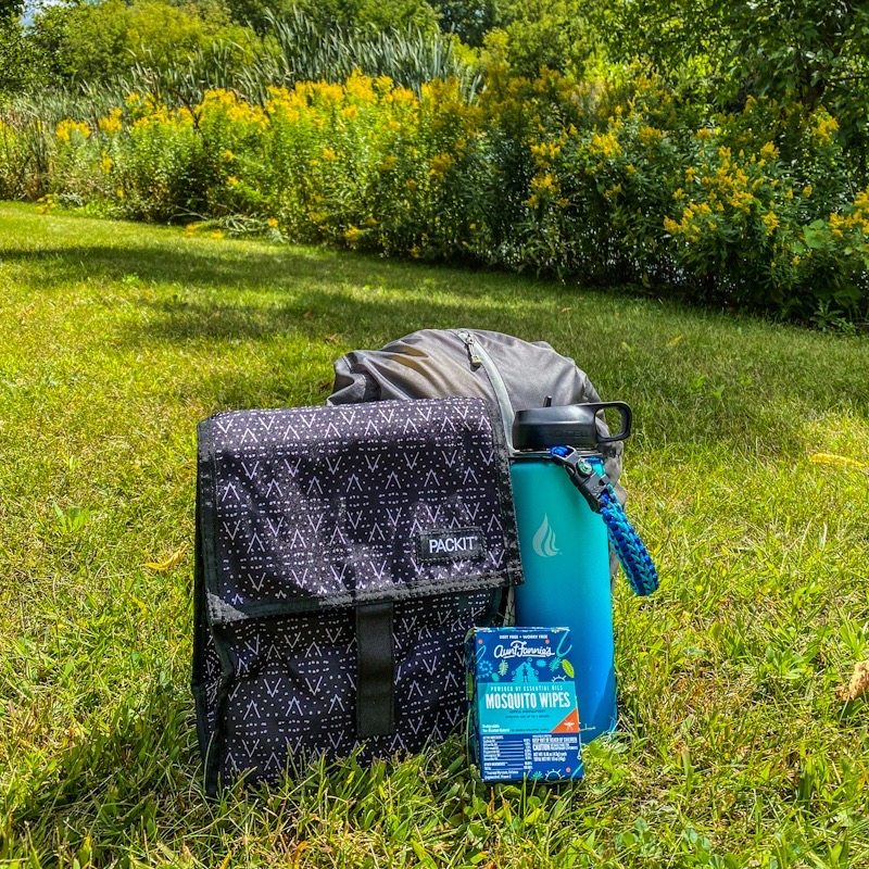
Learn what I never leave home without when going on a day hike. Check out the best day hike packing list / Christmas list and holiday gift guide for hikers. I only recommend products I use and love or would try.
For example, see those biodegradable and DEET-free mosquito wipes from Aunt Fannie’s pictured? I gifted myself an entire case of them. That’s how much I love them – and I’m not even a brand ambassador for Aunt Fannie’s. Well, not a paid one anyway. Although if you make a purchase and use my referral code, I will receive a product credit.
What to wear when hiking in the summer
Are you wondering what to wear while hiking in the summer? Check out this guide on the best summer hiking apparel for safe and comfortable adventures.
The best hiking hats – two of my favorites
And hats! Here are two of my favorite hiking hats on and off the Minnesota trails – a winter fisherman’s cap and a summer baseball cap.
Tenth Street Hats – Santorini Greek fisherman’s cap for fall

I absolutely love my Santorini Greek fisherman’s wool cap – a best seller from the women’s fall collection at Tenth Street Hats. They gifted me this gem of a fall hat in exchange for an honest review. I only recommend products I love and would use myself. And I love this hat – it’s so me!
I have a difficult time finding hats that fit me well so am a little reluctant to order online. However, the Santorini fits me perfectly. The Tenth Street Hats website includes a size guide so you too can get a perfect fit. And if it doesn’t, no worries! They offer free 30-day returns if the hat you select is not quite right for you.

The Santorini hat or any of the other hats from Tenth Street Hat’s fall collections make the perfect gift! If you have a hiker or traveler on your list, they will love it! They also feature several styles of your more traditional hiking hats for all seasons.
If you have a hiker or traveler on your gift list, see my related posts. They include: Travel gift guide and Travel gifts they actually want on Valentine’s Day,
Bad Hair Day baseball cap for hiking

I get so many compliments on this baseball cap asking where they can purchase their own. You can order your distressed Bad Hair Day hat from Amazon (available in a variety of colors). Note that I am an Amazon affiliate. This means I may receive a small commission if you click on the link and purchase this hat. But at no extra cost to you!
As noted previously, I only recommend products I use or would try myself. I actually own two of these Bad Hair Day hats – one in olive green (pictured above) and one in black (pictured below).

Pin it for later
I hope you’re inspired to shake off your cabin fever at one of the best hiking trails within 50 miles of the Twin Cities. You can find many options at state, regional, county, and city park hiking trails near Minneapolis and St. Paul.


I loved this post! So many of these hikes remind me of my native Wisconsin and how beautiful that part of the country is! Kudos to you for hiking so many trails!!!
Thank you so much! Minnesota and Wisconsin both have beautiful parks and trails for sure!
You’re so lucky having all these amazing hikes so close to home. I’d especially enjoy hiking in Minnehaha Regional Park and see that waterfall. Another top one for me would be Summit Ave and dreaming about living in one of those beautiful houses.
I am so grateful to have all these hiking trails so close to home. It’s so good for the soul to connect with nature.
I love your signature hat. It’s perfect for hiking all the best trails in Minnesota.
Thank you! Love my signature Bad Hair Day hat…it’s perfect for hiking in Minnesota.
Very interesting to learn that State Parks close for the deer hunt. The hunt is very popular in Utah too but I don’t think hunting is allowed in the Parks. You have so many varied hikes to choose from. That waterfall in the winter looks awesome.
I was vaguely aware that the parks in Minnesota host deer hunts. Love the frozen waterfalls so plan to check out several others in Minnesota this winter.
Another great post Karen. I think I’d like to most do the sculpture trail, as I enjoy art and it’s a nice easy one for a beginner. Minnesota is so pretty!
Thank you so much! The Caponi Art Park is pretty cool – I’ll publish a detailed post soon.
Absolutely love the waterfall in winter shot! Looks like you have many amazing hiking options!
I love the frozen waterfall also! I hope to discover more this season.
Another splendid collection. I’d be off to the William O’Brien state park, not only was he surely Irish, but the beavers would be amazing to see. Would enjoy the sculpture park immensely too.
He does sound Irish – he was a lumber baron whose daughter donated some acres in his memory. Both William O’Brien and the Caponi Art Park are both great places to visit in Minnesota near the Twin Cities.
I live in the Niagara Region in Ontario and like you, am so fortunate to have an abundance of hiking trails quite literally at my doorstep. The ones you’ve listed here are amazing! It’s so great that these spaces are so close to us so we can take a quick escape or break from life when we need to. The ones you’ve listed here look so peaceful. The Minnehaha trail looks awesome, what a cool place to see during the winter too!
Thank you so much! We are so very fortunate to enjoy so much beauty in our own backyards! Minnehaha is pretty special – and loved that I finally saw the frozen waterfalls last season. I plan to chase more this winter.
I would like to try out Pike Island Hiking Trail. Thanks for the recommendations.
Pike Island hiking trail at Fort Snelling State Park is one of our favorites…I think you love it!
I love how all these hikes are different and unique. I love the waterfall you found and the riverboat. I love to hike near or to the water.
Every hiking trail in Minnesota is definitely different and unique. I love to hike near water also.
I had no idea Minnesota had so many beautiful hikes! Great photos!
Thank you so much! So grateful for all the beautiful hiking trails in the Twin Cities and throughout Minnesota.
This list has so many wonderful options! I’ve never been to Minnesota, but it’s definitely on my list – and hiking is always a must-do. I’m glad you specified some of your favorite hikes on North Shore of Lake Superior – I’ll probably head there first!
Highly recommend the North Shore of Lake Superior – it’s one of my favorite places in the world. So many beautiful hiking trails and waterfalls.
These look like hiking trails. After viewing all the Minnesota state parks, it doesn’t surprise me that there would be amazing trails.
Thanks…we do have some pretty hiking trails in Minnesota.
Who knew Minnesota had so many beautiful and luscious hiking trails! They’re so different from what I’m used to in Alberta but reminds me a lot of some you’ll find in British Columbia!
I’ve never been to BC…but it’s on my list. We do have a lot of beautiful hiking trails in Minnesota.
Looks like so many amazing places to explore and have an adventure!
Most definitely! So many Minnesota hiking adventures!
You have a lot of great walks and love all the fall color you’ve been able to capture along the way!
Thank you! Yes, fall was a great time to visit a lot of these hiking and nature trails and walks near the Twin Cities in Minnesota.
So many beautiful landscapes on so many lovely hikes!
Thank you so much…Minnesota definitely has some beautiful hiking trails so close to the Twin Cities!
I’ve been in the Twin Cities area and had no idea there are so many hiking trails! Good to know. I love being in nature.
We have quite a few great hiking trails nearby here in the Twin Cities…so grateful! And many more I still need to check out.
We would drive through the Summit Ave Historical District when we lived there many years ago. Walking is a great idea!
I had driven through Summit Ave many times over the years…it wasn’t until the summer of 2019 that I finally took a few walking tours…and I’ve been back a few times since. Such a beautiful neighborhood!
I love seeing all of these together. I have enjoyed your state park series. These are some beautiful hikes.
Thank you so much! I’m excited to put together a Minnesota state park travel guide ebook soon (volume 1) and will then create the second volume of the best state parks in Minnesota when I finish my hiking challenge.
These are each such beautiful locations to explore and enjoy!
Thank you so much! So many of the best hiking trails are near Minneapolis and St. Paul.
That’s a lot of lakes and state parks – and waterfalls by the looks of it. And they all look great. I thought I did a lot of hiking in 2020 but your quantity is just astonishing!
Thank you so much! We do have a lot of lakes and state parks in Minnesota – love them all! And love that we have so many great hiking trails near us in the Twin Cities.
It’s great that there are so many state parks around there, they look beautiful! Even the city walks look amazing, those Victorian houses are to die for! This must have taken ages to put together, let alone walk them all!! Have you done them all?!
Thank you so much! I’ve hiked all the ones where I have photos so nearly all that I mention. I did include a couple of trails on my list I plan to hike this year.
What a great blog. I spent little over a year in Twin Cities during grad school and fell In love with the place. I remember doing the Minnehaha Falls hike with friends. Great memories and hiking reminders if we visit the area. Thxs for the blog.
Thank you so much! Minnehaha Falls is one of my favorite places in Minneapolis!
Fantasic post so much information and such a great resource to keep hold of. I do like bookmarking these and keeping them for if I ever make these areas
Thank you so kindly! We have some of the best hiking trails in the Twin Cities.
Amazing post!
Such a great sort of alternatives. I wouldn’t know from where we should start.
We have a life to do the 50! Finger cross very soon!
Thanks for sharing. Great work!
Thank you so much! Greatly appreciate your kind words. I love hiking the best trails near the Twin Cities in Minnesota.
That fisherman’s cap is adorable! Congrats on doing so much hiking during the pandemic. I’m impressed! 40 parks is no joke! Glad you found your outdoor therapy. I would ask you if you’re going to write a book, but I know you’re busy writing a novel. So…maybe a hiking sequel?!
Thank you so much! I love that fisherman’s cap! Love discovering all the best hiking trails in Minnesota and love that so many are in or near the Twin Cities. I am planning to write a local’s guide ebook about my hiking adventures as soon as I wrap up the remaining 26 state parks.
Mill Ruins Park is one I’m waiting to visit because I’m a big history fan. I can’t believe how much wheat was grown in Wisconsin and Minnesota in the 1800s.
I love history also and found Mill Ruins Park and Mill City Museum so fascinating. You’ll learn a lot about why Minneapolis was known as Mill City.
I love this blog! I’m planning my weekend hikes tonight! Thanks for including trail distances – not sure why, but I like knowing.🙂 I just received my State Park Pass in the mail and can’t wait to get started!
Thank you so much! Minnesota offers so many great state park hiking trails and so many close to the Twin Cities.
You’ve found some incredible hikes, way to make good use of the pandemic! 😉 That’s really cool to see the Fitzgerald home as well!
Thank you! That was the silver lining of the pandemic – rediscovering the beauty and history of my own backyard here in and near the Twin Cities. It was super cool to follow in the steps of Fitzgerald’s old stomping grounds.
So many great hikes, and I bet they are pretty fantastic this time of the year with fall colors.
Yes, these are are the best Minnesota hiking trails in and near the Twin Cities. They are especially beautiful in the fall.
These trails all look magical! The frozen waterfalls on the Minnehaha Creek Trail look incredible! I’d love to see them in person! Thanks for the great guide!
Thank you! The frozen Minnehaha Falls are pretty magical – so many beautiful hiking trails near the Twin Cities.
I love that there are so many different hiking options so close to the Twin Cities. It lets you enjoy the city life but easily get out into nature. Such varied sights on the hikes too! A great reference post to keep handy for a visit to the area.
Thanks! We are so fortunate to have so many green spaces and hiking trails near the Twin Cities. Love sharing my local’s guide to the best trails.
Wow, I can see that you put a lot of effort in your articles. Yet its so easy to read.. well done. Will go to check your other articles now. Great job 🙂
Thank you so much for your kind words. Greatly appreciate your support!
I had no idea there were so many trails in Minnesota! The sculpture trail sounds so cool.
We definitely have a lot of trails throughout Minnesota. The sculpture trail is one of my favorites in the Twin Cities.
The photography just brings me there – so pretty
Thank you so much! So many beautiful hiking trails in and near the Twin Cities.
Willow River Park is my fav. I can literally smell the fresh air through the screen.
Thank you! Willow Falls an Willow River State Park is so beautiful! And it’s a short drive from the Twin Cities.
I just love seeing all of the beautiful scenery and lush greenery in your posts! I can just imagine myself hiking along these best hiking trails within 50 miles of the Twin Cities…hopefully someday!
Thank you so kindly. Lots of beautiful hiking trails in and near the Twin Cities.
My cousin is travelling around the US right now and he loves camping and hiking! I’ll have to pass this on to him!
How fun! And thank you for sharing! This guide to the best Minnesota hiking trails within 50 miles of the Twin Cities is one of my most popular (and favorite) posts. I’m constantly adding new places to hike.
We tend to zoom through twin cities to get to BWCA. So many great options for hiking that are not as hard to get to though! I have new ideas now for hiking! Thanks!
I can’t blame you for heading straight to the Boundary Waters in Minnesota. If you ever get the chance to spend time in the Twin Cities, you can find lots of the best hiking trails in Minneapolis and St. Paul.