
Why I need hiking apps when I unplug
So I’m on a mission to explore all 66 Minnesota state parks. While my friends and husband have accompanied me on several of my hiking adventures, many times I am hiking solo. And for those who know me, I am directionally challenged. Additionally, although I somehow managed a B in college botany and earned a slew of Girl Scout badges back in the day, I think everything is poison ivy (it’s typically raspberry brambles). For those reasons, I do not leave home without the top day hike apps. So if you’re a day hiker like me (i.e., not scaling mountains), here are my recommended favorite hiking phone apps.
First, I must fully disclose what happens if you click on any of the links to products and services in this post. While you will not accrue any additional costs to support my blog, I may – as a marketing affiliate – receive compensation if you link to or purchase products and services from places such as Amazon, Bluehost, Constant Contact, It’s a Lovely Life, HotelsCombined, etc.
Recommended hiking apps


While there are several cool apps available, here are my current recommended top five hiking apps.
AllTrails Pro app


I cannot praise or give enough stars for the AllTrails Pro app (not an affiliate partner, which means I’m not paid to say any of this; just a huge fan). The AllTrails app includes more than 100,000 curated trail maps, reviews and photos from its community of more than 20 million hikers.
I’m notorious for thinking I know where I’m going even though everyone knows that I don’t. How I survived any hiking trails before I discovered AllTrails Pro is pure luck. Whether I’m hiking solo or with friends and family, I’m confident I’m going in the right direction.
You can assume I’m wrong if I ever say I know where I’m going.
While there is a free version of AllTrails, I upgraded to the paid version, which is currently only $30 a year (with no ads).
You can download AllTrails hand-curated trail maps on your phone before you leave home or your cabin or wherever you are connected to service. Many of Minnesota state park trails are in remote areas so sometimes cell phone service is spotty or none at all. No worries as the AllTrails maps will track your exact GPS location even without any bars or signal.
AllTrails Pro app features and benefits
Here are the AllTrails Pro features and benefits and why I love and trust this day hiking app.
- GPS service even when you’re offline – the integrated maps are helpful when you don’t have service on the hiking trails. Just download the maps ahead of time and it will track you throughout your hike.
- With off-route alerts, you’ll receive notifications if you are going the wrong way.
- The downloaded AllTrails map shows the hiking trail starting point, total distance and elevation at regular mileage intervals.
- Love the safety feature where you can share the trail directly from the app by email or text. The Lifeline feature includes your start/finish time and map route, and will let your safety contacts know your last known location if you’re overdue.
- The AllTrails Pro tag features let you know if dogs are allowed (usually on a leash), kid-friendly, cross-country skiing, lake, wildlife, etc.
- Peer reviews and ratings are especially helpful (love to learn ahead of time if a certain hiking trail is notorious for mosquitos and deer ticks so that I am prepared or avoid those particular trails until the fall). Tip: I’m a big fan of Aunt Fannie’s DEET-free mosquito repellent wipes (Aunt Fannie’s also comes in a spray…haven’t used this version yet as I like the convenience of keeping a prepackaged wipe in my legging slash pocket). I have not had any mosquito bites where I’ve applied Aunt Fannie’s wipes. And I’ve been walking in some serious mosquito breeding ground.
- Other AllTrails Pro features include nearby trails, landmarks, trailheads, weather conditions, pollution, pollen, etc.
- And if you’re looking for more solitude in this social-distancing era, user heat maps can tell you how populated the trails are so you can better plan your hiking adventure.
- I always like having the old-school map so you do have the option to print your routes or take screenshots saved to your phone. Just remember to bring a charged charger (one of my favorite day hiking products I don’t leave home without).
- Giving back! AllTrails, a member of 1% for the Planet, donates 1% of their annual sales to nonprofits that protect the environment.
PictureThis app – plant identifier
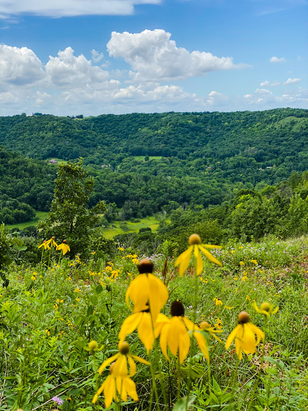

I originally downloaded PictureThis app when I was downsizing my overgrown and neglected flower garden. I didn’t know the difference between a weed and a flower. The PictureThis plant identifier app (aka a botanist in your pocket) comes with a lot of free functions, but I upgraded to the paid version for only $30.
Now I use PictureThis app frequently during my day hikes to identify plants (that are not usually poison ivy), wildflowers, mushrooms, trees, etc.
Currently, PictureThis app is only available to download from the App Store for iPhones and iPads. So if you have an Apple mobile device, here are some of the cool functionalities – on and off the hiking trails.
- Identify flower, leaf, tree, herb with just a simple snapshot.
- After snapping the photo, you’ll receive the name, genus, botanical name, description and care guide.
- Ask questions and get expert opinions online via the PictureThis app.
- Lots of gardening and houseplant care tips, care guides and weed identification and control.
- Upload a photo of a plant’s sick parts (that’s what they call it) and PictureThis app will diagnose plant problems.
- Flower of the week (check out my sunflower farm experience).
- Keeps a record of all your collections so you can archive for future use (includes FAQs, name etymology, fun facts, symbolism, common pests and diseases and more
iBird Pro – birds identifier app
I haven’t used the iBird Pro app yet, but have read good reviews so am thinking about downloading it for the field guide especially. Have you tried it?
iBird Pro (currently only for iPhone) functionality includes:
- Guided by the most recent American Ornithological Union standards (so that’s a credible resource).
- iBird’s search engine features more than 35 characteristics that you can search, such as body color, GPS location, habitat, bill shape, song type, etc.
- This app’s database features more than 900 species of North American birds – as well as four other regions from around the world, including the UK, Ireland, Hawaii and Palau.
- After snapping or uploading a photo, the iBird Pro Photo Sleuth will provide the bird name within seconds.
- In addition to a database of photographs, iBird Pro includes illustrations for all species. In fact, it has more than 1,000 composite illustrations. And includes images for male, female, juvenile and subspecies.
- We have a lot of birds just in our backyard so would love to use the iBird function that contains more than 4,000 bird songs and bird calls. I mean I can identify the haunting loon call and the frog-croaking egret, but an unable to identify most of the backyard birds.
- And just like AllTrails, iBird does not require an internet connection – so you can use the functionality when hiking without service.
iNaturalist – an app for the community for naturalists
iNaturalist is a pretty cool app that I learned about from another travel blogger, Leeanne with In the Olive Groves. iNaturalist is a joint initiative of the California Academy of Sciences and the National Geographic Society.
Fun and interesting features include
- You can explore what others in your own neighborhood have captured and uploaded to the iNaturalist app. For example, in my own neighborhood, I open up a pin location and I can see at a glance the nature image, the user name, the date of the picture, the name and species as well as a shore description and a map where you can find them in the U.S.
This app is an opportunity to record and share your flora and fauna observations with different scientific collection organizations to help scientists throughout the world. The iNaturalist app works with all mobile phones.
SkyView – stargazing app


I must have missed that day in class where we learned about all the different stars and constellations. I can pick out the Big Dipper and the Little Dipper on my own. But that’s pretty much it. Until my husband (who learned about it from his sister) introduced me to the SkyView stargazing app. You can use SkyView Light for free or upgrade to SkyView for $1.99.
Now this app isn’t exactly for day hiking, but if you’re sleeping out under the stars, camping, glamping or sitting by your backyard bonfire, the super cool SkyView functionality includes some cool stuff.
- Point your camera on your mobile device to the night sky, and the SkyView app will identify stars, constellations, the moon, planets and more.
- After SkyView identifies the constellation, it’ll share where you can find it in the sky (e.g., located in southern hemisphere near the center of the Milky Way).
- SkyView Sightings informs you the best time to see space sightings such as the moon, Capella, Rigel, Sirius (full disclosure, I had to look the last three up…they’re three of the brightest stars just in case you missed that day of class also).
- You can also set up notifications so you don’t miss out on stargazing events.
So those are my top hiking apps that I recommend for your adventures outside. Another app I’m looking into that was recommended by Forbes magazine, is bSafe. This app features: an SOS button, voice activation, live streaming, recording, guardians (personal security network), follow me, siren, and more. I’ll update this post and write a review once I use it. Have you used it?


Pin it for later


Related articles










I like the idea of a plant identifier app. That’s something I’d use. I use an app to find the milky way, sunrise, and sunset.
The PictureThis plant id app is so cool and informative!
Great app ideas! I think would love the AllTrails app, if only to know “how much farther until we get there?” And I love the mosquito repellent tip!
Ha! Yes, we felt the same when I was wondering how soon before I got to the flat trail (after a very strenuous and rugged trail).
Oooo I’m so interested in several of these apps! I often head down a trail on my own too. Thanks for the suggestions!
Awesome…happy to hear you’ll find them of value…I certainly do!
I love AllTrails and use it often! I hadn’t heard of the others – thanks for sharing.
My pleasure! Isn’t AllTrails amazing?!
We like using the AllTrails app too. It helps us to create lists of hikes that we would like to go on.
AllTrails is my favorite hiking app!
These are cool! I’ve never really looked into apps while hiking, but on my last trip, I probably could’ve used one as we returned in the dark. It was a little nerve-wracking hoping we were on the right trail. The stargazing one would be helpful, too.
I just started using the AllTrails app this past summer when I began doing more solo hiking. Ohhhh…I would be so nervous hiking in the dark.
We love all trails! Picture this seems pretty awesome! I never know anything about plants 😂
I’m a huge fan of AllTrails especially! I don’t know anything about plants…it’s really handy when I’m out weeding the garden also.
That stargazing app looks really cool.
It is super cool…it’s my husband’s favorite!
I love your choice of apps. I use AllTrails just to find new places to hike. And iNaturalist for the Girl Scouts. They love adding to it and helping scientists track animals and plants.
Thank you! You’re the one who introduced me to iNaturalist…such a cool app!
I love the plant identifier! What a great idea. I am definitely downloading that for my next hike. Thanks!
I use PictureThis plant identifier a lot…so much information!
WOW! Amazing that there is an app for almost everything! 🙂
It truly seems that way!
Wow Karen!! These are great apps!! I use All Trails and Sky View. But I’m always trying to identify plants and birds. So excited for these! Great idea, pinned this for later!
Thank you so much! I hope you find them as valuable as I do!
Picture This and Skyview are so cool, and ones I’d like to use. It’s great that we’ve so many apps now, we’re so spoiled!
They are pretty cool…and we are spoiled! I don’t know how I survived before! Ha!
great idea!! will certainly be looking into the stargazing one!!
That’s my husband’s favorite! He used it last night to look at Jupiter and Saturn as they were pretty bright.
I’ve never even thought about downloading apps for hiking, I love this post! All Trails is definitely something I wish I’d had a long time ago! I love the look of SkyView, I’ve always been so fascinated by the stars and would love to know which constellations are which by the ease of an app! Thanks for sharing!
My pleasure! I’m loving them as they add value to the hikes and are not distractions.
These are some great recommendations! Like you, I love hiking but I’m directionally challenged and managed to get lost when navigating my local high street! To be honest I’m not often an app user! I generally buy a book with hiking routes in it or print out written instructions. When we climbed Snowdon last year I had 3 different printed instructions with me and when we got there the path was really obvious! I definitely want to try some of these apps out in the future, they look awesome. Thanks for highlighting them!
My pleasure…and thank you so much! I also like to have a printout – what’s really nice about AllTrails is that it shows me in real time if I’m heading the right way.
These are great apps to know about when you’re hiking. Especially is it’s a plant or area to avoid.
I’m really loving these apps.
These are great apps! We use AllTrails all of the time, as well as PictureThis and Skyview. I will check out the other apps; I’m always looking for things to make life easier!
AllTrails is so awesome – used it a lot over the past two days as well as PictureThis on my hikes.
Awesome recommendations for hiking apps, Karen! Does AllTrails have international trails as well as U.S. ones? I usually rely on Google and/or print maps I pick up at visitor centers. Lots of room for error there!
Thank you so much! Yes, AllTrails does have international trails (some of those in our travel tribe network use them). I love that it shows me in real-time if I’m moving in the right direction when I’m not clear on which way to go (which is almost always).
Wow, I have never heard of most of these apps! They are really useful!
They are pretty awesome and so helpful!
This is a really useful post, particularly for us. We love a good hike! May give the Alltrails a go. Thanks
I use AllTrails frequently…it’s my favorite hiking app.
I use i naturalist for all plants and birds, very handy. I’ve yet to upgrade to AllTrails paid version, but I will. The regular app is great, but I need those pro features.
I’m so happy I upgraded – the past three parks I’ve been to have not been well-marked with a lot of offshoot paths so it was nice to know when I was at least headed in the right direction.
I’m definitely going to check out Skyview and AllTrails. We are NOT hikers, BUT I feel like if I can see the whole overviewe then I might actually take the first step!
They are awesome apps whether you hike or just hanging out in your own backyard.
Woah! I didn’t even know there were hiking apps. These all look amazing. Thank you so much for sharing!
Thank you and my pleasure! I especially love AllTrails! It’s one of the best day hiking apps. And I use Picture This app quite a bit on my hikes as well.
As a self-proclaimed homebody, these apps would definitely help should I venture out. Thanks!
Awesome…these are very helpful day hiking apps! And they are very useful even in your own garden or local parks.
I am always looking for apps when I am traveling and hiking! Thanks so much for the useful information.
You’re welcome and my pleasure! Love sharing what I find valueable – and these are the best day hiking apps!
OMG, I’ve been pondering getting a hiking trail app for ages, so looks like AllTrails is what I need! Sometimes not knowing the details of the hike make it a bit intimidating (esp. for us, as we’re not very hikey) 😉
You will love AllTrails! It’s perfect for us day hikers especially! I am so directionally challenged and this hiking app is the best and has saved me more than once.
We love all trails thanks for the other great ideas!
Thank you and my pleasure. AllTrails is definitely my go-to hiking app.